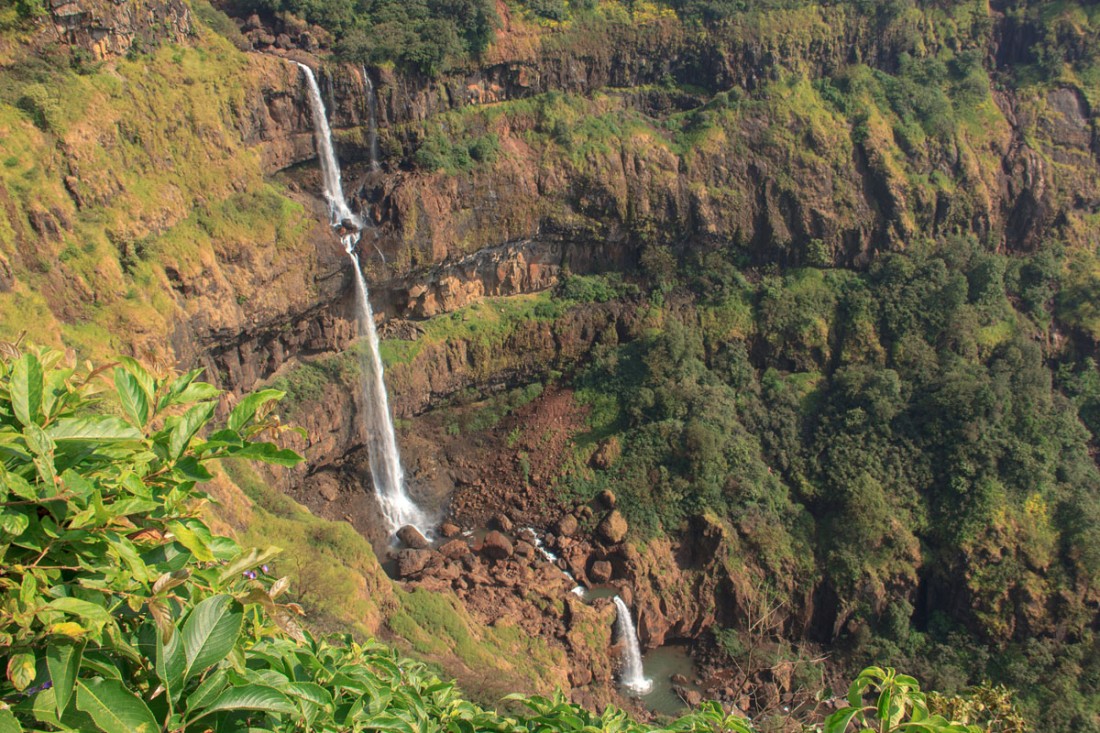
Sight Seeing, Waterfalls and Selfie Points
Lingmala Water Fall, Dhobi Water fall, Chinamans Waterfall, Kelghar water fall, Ales waterfall, Pratapgadh, Chirkehind Fall, Bhilar waterfall, Kshetra mahabaleshwar old Mahabaleshwar 5kms 1316meters, Krishna, Koyna, Venna, Savitri and Gayatri, the temple panchganga Mandir, Venna Lake, The PratapGadh Fort 21kms, Arthur seat Point 12km, 1347 meters kamalgadh, Monkey point, Bombay point, Babington point, Kates point, Elphinstone point, Falkland Wilson Point, Tapola, Galoni Point, Baghdad Point, Robbers caves, Cannought Peak, Lodwick point, Lamington Plateau.
[amazon_link asins=’B073YB9FPX,B06WWL4JD8,B00IHS3RGQ,B01D4EYNUG’ template=’ProductGrid’ store=’themumbaimall-21′ marketplace=’IN’ link_id=’16b908ce-d5a3-11e7-8ad7-6d8e3d9f5390′]
Lingmala Water Fall : The major attraction of mahabaleshwar on the Venna river is visible from the kalghar ghat on the medha satara road, and offers an awesome spectacle from the Met gutad villages Makharia point. One can also see the actual point of the water falling from Shreyas Bungalow , or Saj Resort at Met Gutad but one has to be very cautious while moving around these places. The spectacle of this fall is visible during the monsoon and few months after the monsoon. Bungalows on Rent available near this point are
a] La Rose b] Cloud green c] Sai Villa.
- Dhobi Water fall : known so as may be because it was once a very prominent washing place. On the ride besides lilly cottage on the kshetra Mahabaleshwar road.
- Chinaman’s Waterfall: Near Sassoon point and the Falkland point is known so as because of the inhabitation of the area by the Chinese prisoners of war during the colonial rule and a majority of this site was used by them for cultivation of various European vegetables and crops.
- Kelghar water fall: on the Mahabaleshwar medha satara road almost 14 to 15 kilometers away from the main market place seen in the monsoon season only.
- Ale’s waterfall on the tapola road near zolchikhind is near about 8 to 9 kilometers from the market place and seen in the monsoon.
- Pratapgadh view water fall in the anbenali ghat about a kilometer and half from the sight of medtale village. This place also offers a beautifull view of pratapgadh fort from ghat.
- Chirkehind Fall in the lower portion of the ambenali ghat about 6-7 kms after the diversion to ragtag.
- Bhilar waterfall seen on the mahabaleshwar panchgani road is one of the beautiful falls on the kudali river arisisng from the bhilar village.
Visitors are requested to take adequate care while they are moving in the vicinity of these falls.
Kshetra mahabaleshwar (old Mahabaleshwar) 5.5kms: 1316meters .
Considered, as the most pious Tirth Kshetra in Maharashtra due to the various holy sites here is known to be in existence since the prehistoric times and was a place of pilgrimage to one of the most renowned saints who were being terrorized by two dreadful demons namely Mahabli and Atibali.
As legends say lord Vishnu pleased by penance of the priest who requested relief from the dreadful demons to him. In a furious combat killed the younger demon atibali that angered the elder demon further who was not easily surmountable to Lord Vishnu and had to seek the assistance of Lord Shiva.
Mahabali on the contrary being a worshipper of lord shiva was not ready to fight against the lord and accepted death by wish (ichamaran) and in return asked the Gods to attach his name to the Lords and the place to be known by it and so the term Mahabaleshwar was coined.
Many holy rituals and holy offerings that were in the from of hom and havan in the presence of lord Brahma Vishnu and Mahesh marked vistory over demons.
These celebrations as legends say, were responsible of transforming the three gods into solid rock as seen on the swayambho shivling and the arising of lord brahmas wife gayatri in the liquid form here due to the curse and counter curse of the later to the former for having commenced the holy celebrations in her absence.
This Swayambho Shivling temple was built by Raja Sighana of Deogiri in about 1215A.D further by krishnaji Baji More in 1578. then followed by Chattrapati Shivaji Maharaj. A large fair at MahaShivratri (birth of Lord Shiva) takes place here.
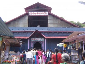
But to history it is also known as the origin of the five rivers they are Krishna, Koyna, Venna, Savitri, and Gayatri the temple ( panchganga Mandir) was built by Chandrarao More of Javali.
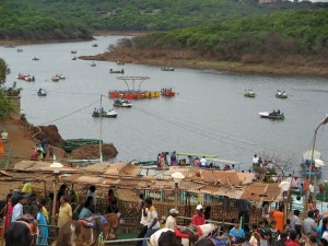
Venna Lake
The natural springs in the rocky area where the lake is situated today were strongly recommended to be converted in to a fresh water by Dr. Murray, as he advocated the concept of the lake maintaining the climate of mahabaleshwar cool during the summer by the warm and cold air current circulation due to its appropriate location and most important of being able to overcome the water shortage especially during summer and thirdly easy cultivation on the silt lands surrounding the lake sides.
In 1842 the lake was finally constructed with a dam being made on the eastern side of the lake under the supervision of sir james Rivet Carnac measuring an area of 28 acres and an average depth of 10feet. The eastern overflow of the tributary of the lake flows don as the venna river merges at mahuli near Satara with the Krishna river that further at karad merges with the koyna river.
The venna lake is today a popular picnic spot and an entertainment junction. Visitors spend time walking on the lanes besides the lake eating a variety of food stalls or boating on the sparkling waters of the lake or gaming and horse riding getting very popular here now
[amazon_link asins=’B06XR36WF6,B06X9YZR91,B0768GCP1H,B071CY7ZGM’ template=’ProductGrid’ store=’themumbaimall-21′ marketplace=’IN’ link_id=’3f6616fa-d5a3-11e7-995f-65eba40be4ea’]
The PratapGadh Fort (21kms): Down the radtondi ghat and up the dhorpia built by the great maratha Warrior Chattrapati Shivaji Maaharaj lays the historical fort of Pratapgadh.
Going a few hundred yards towards the eastwards is the temple dedicated to the bhavani mata the present priest of the temple is a lineal descendent of viswanath Bhatt hadap appointed by porpant pingale.
The northern eminences are the inner fort or the balekilla as known with a smaller palace or the gernanace hall of the king which is entered through a smaller but a even stronger gate on the prior to which towards the right hand side one passes a hanuman temple worshipped by the guru of Chattrapati Shivaji Maharaj: Swami Ramdas.
Entering the Balekilla towards the left hand side are seen the remains of what used to be the court at the fort and opposite to which is the kedareshwar temple the guardian deity of the fort.
The western side of the fort with the steepest precipices descending in to the konkan valley below is the punishment point or what is known as kadelot point.
Sighted from pratapgadh eastwards is mahabaleshwar and southwest is seen the saddleback shaped makarandgadh at a height of 4045 feet above sea levele and was dwelt by the pandavas during their exile for 14 years to the forests.
Arthur seat point is the deepest precipices in the region giving a heart throbbing view of the konkan valley below & towards the eastwards side lays an old road used by the Maratha warriors during the attack by Chattrapati Shivaji Maharaj on afzal Khan.
The area between Kshetra Mahabaleshwar and Arthur seat point are known as Brahma arayna a place used by prehistoricsaints for peneance and religious obligations the soil here is grayish in colour that is considered as the ashes or the bhasma of the religious yagnas(pious offerings made with vedic chants to the fire). The caves of these Rishi still in the vicinity.
kamalgadh
A tabular plateau on the other side of the Krishna river in the Krishna valley eastwards to mahabaleshwar on the confluence of the Krishna and the walki river stands this gigantic mountain amidst dense lush green forest at a height of 4510 feet from sea level, with an eminence of 4 to 5 acres a top.
Kamalgadh has no reminisces or ruins on it hence difficult to ascertain it historic significance, though there is a temple of gorekeshnath one of the nine naths from the navnath puran and said he used to do penance and offer religious rituals here. It is a popular camping center for the locals.
Monkey point
Again on the same road to Arthur seat point, a few meters away from Marjorie point a view of the sahyadri ridges descending down to the konkan shows huge stone and boilder structures as if to resemble the heritance of monkeys and thus known as monkey point.
Bombay point
Named by Dr.James Murray former superintendent in the british rule and perhaps known so as this is the first point or summit on arrival to mahabaleshwar from mumbai up the Fitzgerald ghat and secondly in those days the Bombay harbor on clear days was visible from here and one could sight boats and light house.
A pleasurable sun set point & seen here is an old bandstand which was used to play a real life band by the Europeans while the sunset. Seen to the left is the makarandgadh and in front lies the pratapgadh fort.
In a funny but not rather very funny this place was nicknamed as scandal point where the evening sunset was mesmerized in the gossip and guesses of the well to be people of the richer societies.
On the tapola road a few minute drive from the forest office is also a pleasant walking road owing to the cover of the dense jamul forest overhead is a small open space off the tapola road looking down the konkan valley with the makarandgadh in the distance. A popular picnic spot and a sunset point.
Kate’s point
Off the road to panchgani is this spur of land that overlooks the Krishna valley is a major center of tourist attraction. On the west side is the echo point that offers an echo of 3 to 5 reflexes. Seen from here is the scenic beauty overlooking the joar valley and the balkawadi dam on the backwater of the dhom dam on the Krishna valley.
The actual point came to be known as kate’s point after sir james malcolm’s daughter Kate’s made a liking for the same and spent hours enjoying the scenic beauty of the point.
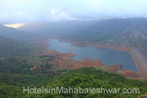
Seen from kates point towards the west is the kshetra mahabaleshwar from the the foothills which is seen the serpentine streaming of the Krishna river from its origin above at kshetra mahabaleshwar. Seen eastwards are the kamalgadh fort and the sangam of the walki river and the Krishna river.
Seen eastwards the great cuboids pandavgadh in the back hills of which lies the historic temple of the great deity mandhardevi. Eastwards seen is the historic city wai and towards the west is the dhoom dam and eastern hills nesting another hill resort – panchgani.
While walking eastwards away from kates point one comes to a spot known as needle hole with gigantic opening in the posterior end of the kates point which resembles the threading end of a needle hole, on even closer observation of the same it also appears to resemble the trunk of the elephant with huge ears and its trunk running down the hill side.
Elphinstone point
On the way to Arthur seat point offering a majestic view of the konkan valley below, mahabaleshwar seen southwards, the saddleback makrandgadh southwest and the historic jaoli northwards and the arthur seat point towards the far east & westwards are the historic fort of pratapgadh.
These points located in the vicinity of the Bombay point, on the tiger path named after two governors of Bombay sir Falkland & sir james carnac. Both these points offering a view of the koyna valley and the makarandgadh.
Named after yet another governor sir, leslie Wilson. A flat plateau covering an area of 40acres and the highest summit in the hills of mahabaleshwar. It was known as the sindola hill during the colonial rule .
Offering a spectacular sunrise and sunset from the same place is perhaps the only point of its kind in mahabaleshwar. The beauty of this one time royal air force base during the second world war is enchanting & the dense green forest offers a spectacular glance in all the directions of mahabaleshwar.
On the south of mahabaleshwar down the tapola ghat in the koyna valley is a small town on the extreme backwaters of the triveni sangam of the koyna, solshi and the kandhati river. Locally coined, as Mini Kashmir due to the serenity and the beauty of the shivsagar lake is an excellent boating and picnic spot.
1274 mtrs off the tapola road past the maharul village, a walk leads to this point above the tapola ghat giving a view of the mahabaleshwar plateau and the koyna and the blue river valleys. It is recommended to take the assistance of the local guide here.
Past the satara road on the kelghar ghats towards the villages of rengdi, it is easier to locate it as the end of the road takes us to backwaters of the kanehar dam a beautiful spectacular view of the mahabaleshwar plateau and the valleys below.
Scary as it sounds is also known as shin-shin gully located on the tapola road on the ride just a few yards before the village of manghar towards tapola on leading the ride one comes to a opening in the ground which has a sudden fall leading to concealed fall in the form of a cave.
Cannought Peak
On the road to kshetra mahabaleshwar this small hillock is perhaps the second highest peak in mahabaleshwar after the Wilson point. Initially known as mount Olympia until 1890 and named after the duke of cannought who adored the beauty of the place very much and often visited this place.
Like Wilson point it gives a spectacular of the mahabaleshwar plateau in all directions and is a popular sunrise and sunset point, a popular picnic spot is also ideal for outings and forest trek along the point rides to Arthur seat point.
n
The most exotic view of the forest, from the parking area a walk leads to the top of a summit where lies a monument erected in the memory of general lodwick erected by his son in 1870. Seen below is the serpentine Fitzgerald ghat with the pratapgadh fort in the front and at the foothills the historic village of jaoli. Makarandgadh seen to the south west, and north east ward seen the elphinstone point. Northwards from the monument is a point led by a very narrow walk between the two ravines has a shape to resemble that of an elephant’s head. The nose tip was also known as the Sydney point. It is said that the sea was very clearly visible from here on very clear days.
Lamington Plateau


No Comments